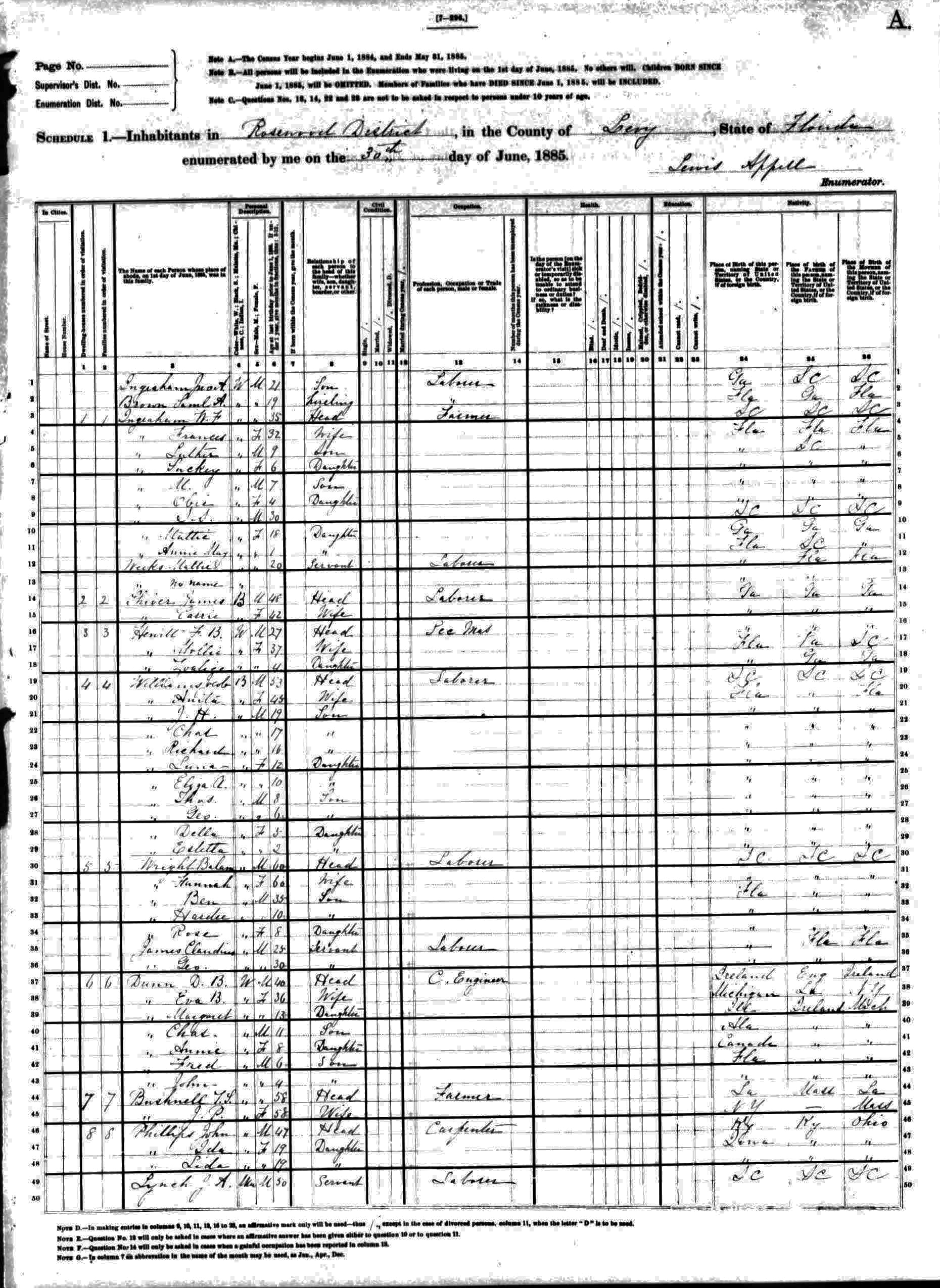
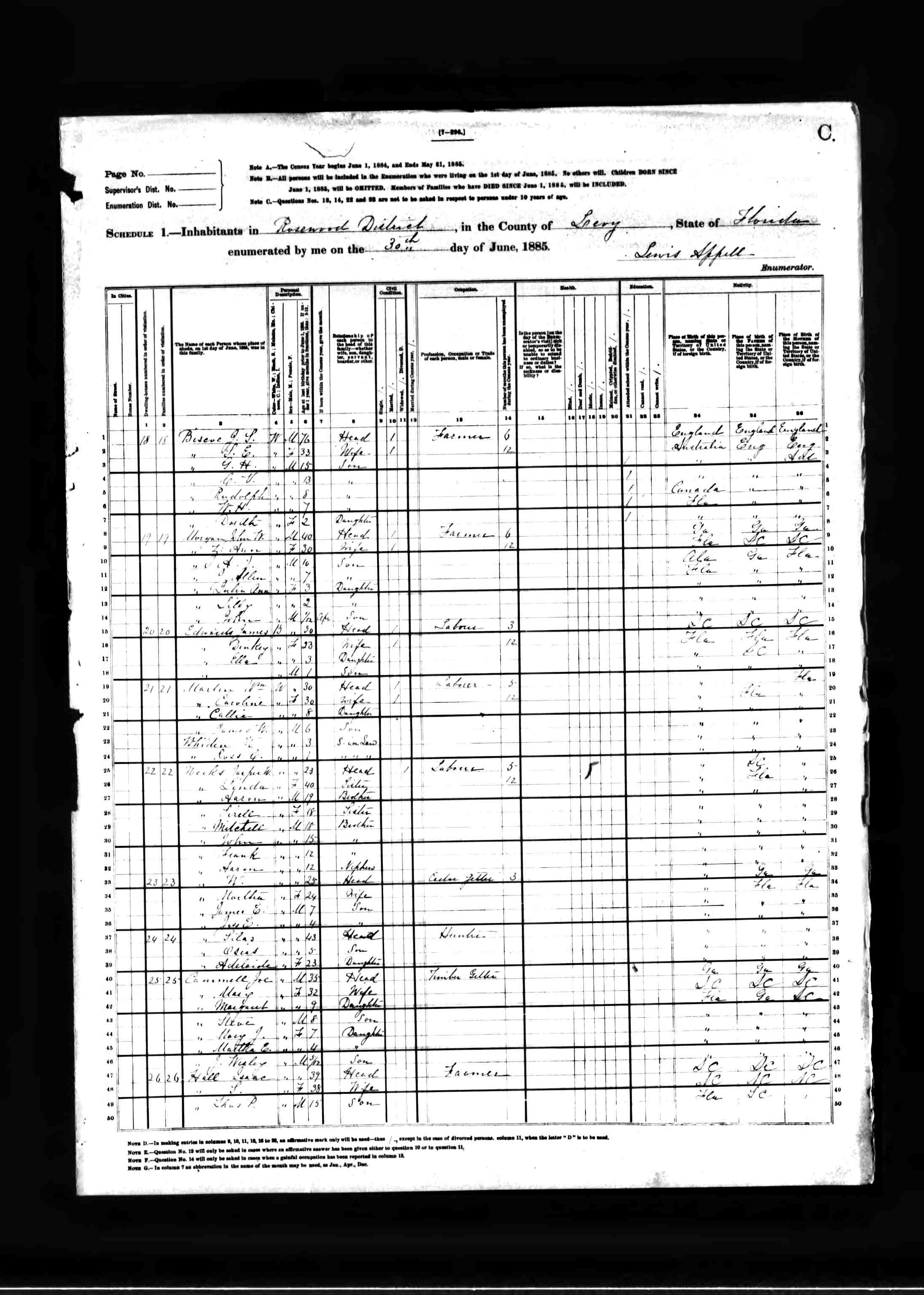
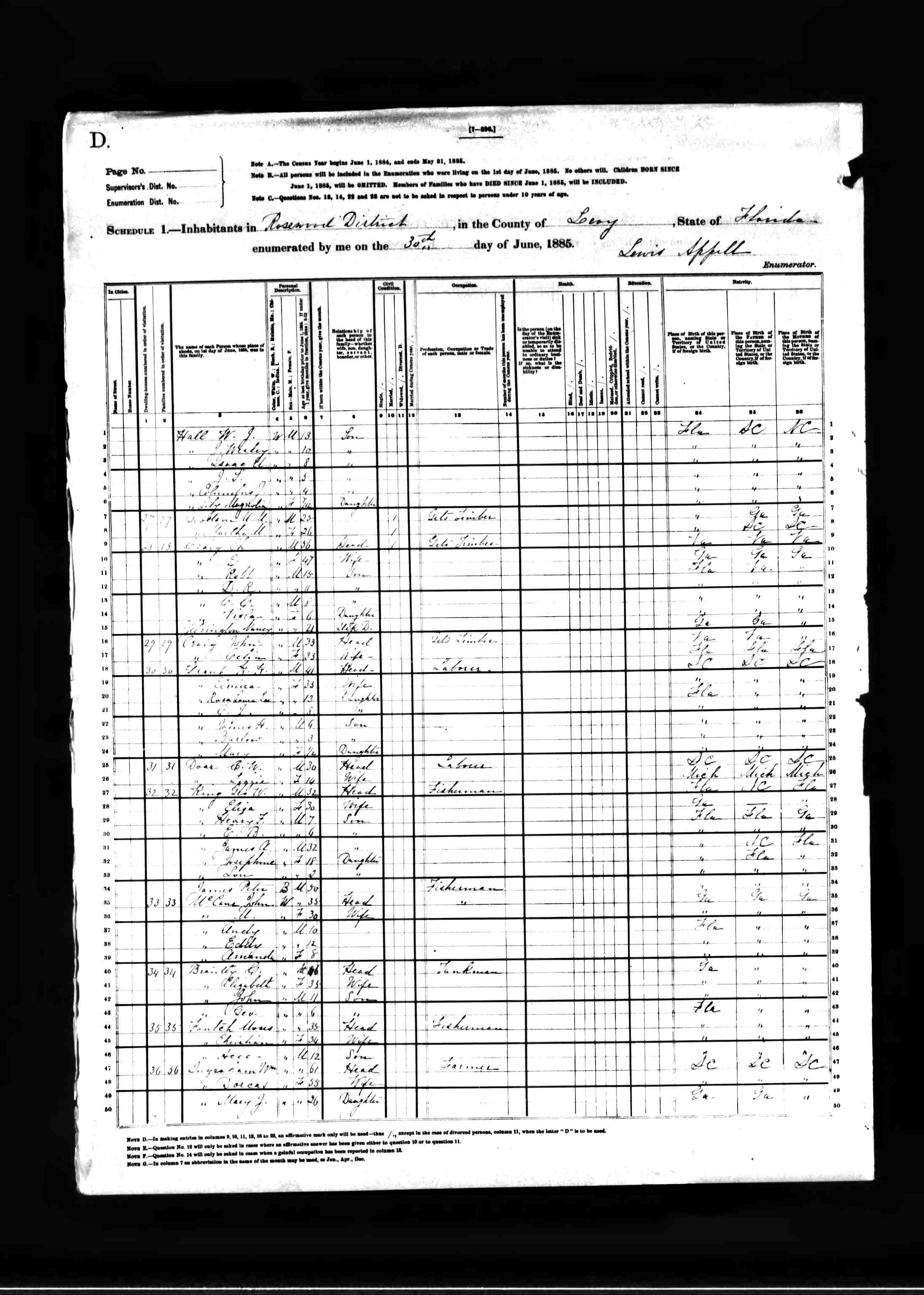
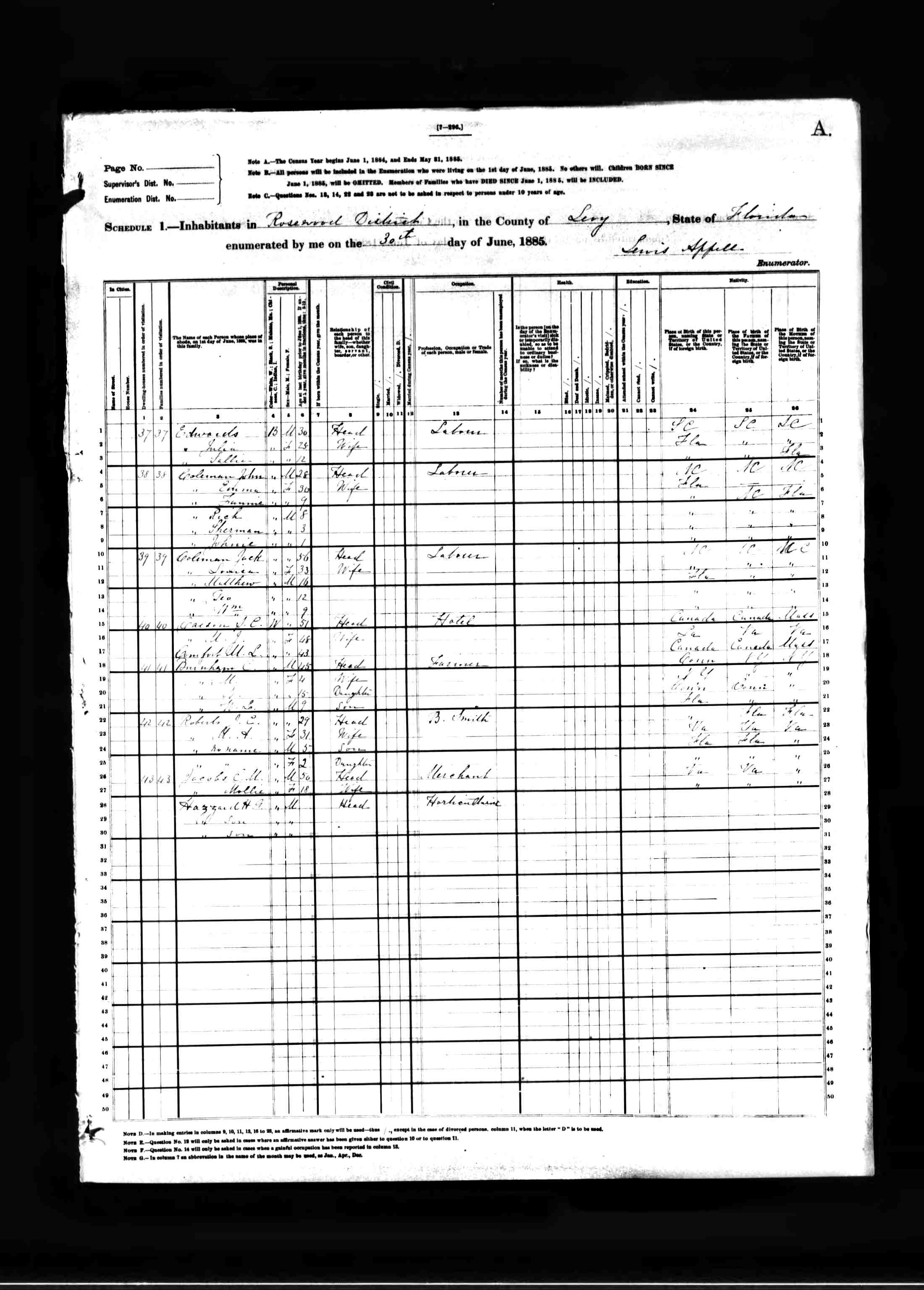
This page is a clearinghouse for transcribed census data. Federal and state census records often record data about race, gender, age, home ownership, employment, composition of households, and so forth. Research on Rosewood by others prior to 2005 focused on the 1920 census. This was largely due to the difficulty associated with accessing historical census records in the 1990s and earlier. Accessing these records has become much easier.
At present, the following records are available, others will be added as they are transcribed. The 1885 state census includes links to the original scanned images and a trascribed spreadsheet.
1885 State Census Transcription – Images (1) (2) (3) (4) (5)
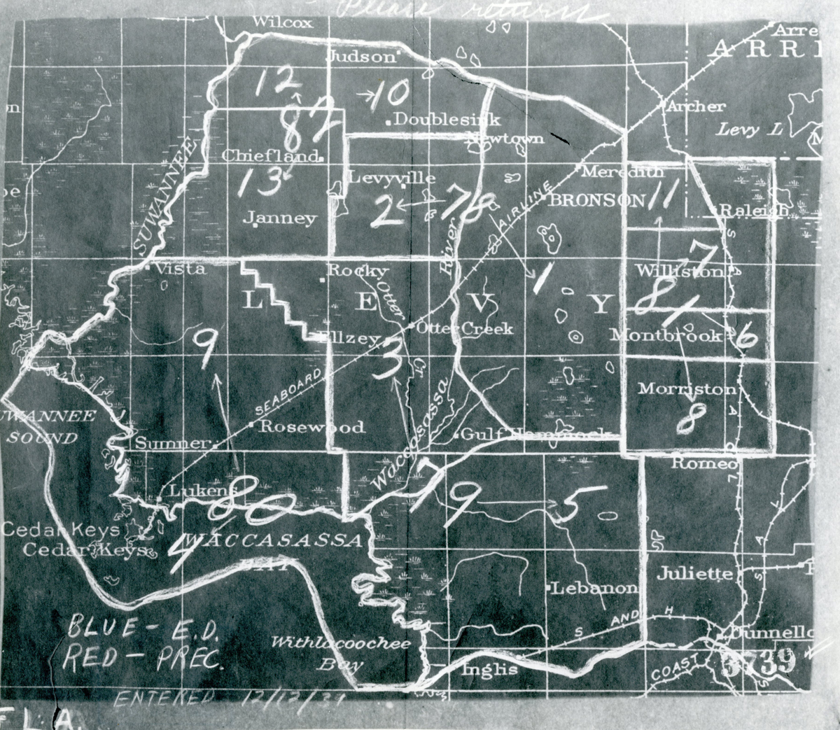
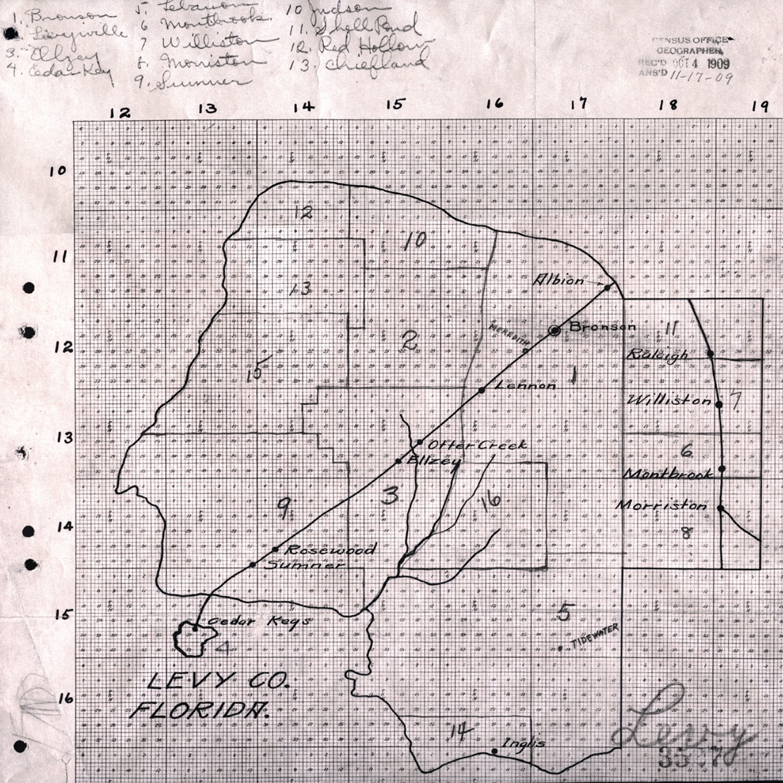
The 1900, 1910, and 1920 federal census data is based on enumeration district. Enumeration districts in the vicinity of Rosewood include other areas as well. As such, a map of each of the enumeration district is included in addition to the spreadsheets for each census.
1900 Federal Census Transcription – 1900 Enumeration District
1910 Federal Census Transcription – 1910 Enumeration District
1920 Federal Census Transcription – 1920 Enumeration District
These materials are freely offered and no ownership is made. You can use them as you wish. You are not required to cite this page or project. Census data is often freely available, and this page simply offers a convenient way of accessing this important information for Rosewood through time.